Helsinki region land cover dataset
In the dataset, the land area is classified into impermeable surfaces such as streets and buildings, vegetation of different heights, open rock, and bare ground. It is used for example in stormwater management, monitoring the environment and in research.

The dataset is produced using orthoimages, Lidar point clouds and GIS data from the municipalities. It has been produced every two years in co-operation between HSY and the municipalities of Helsinki region since 2014.
The land cover dataset is published as open data. It is available in our web map service and via our open geographic interfaces. If you need the dataset from a specific area, please send an email to sepe@hsy.fi. The dataset is available in both vector and raster format, and the coordinate system is ETRS-GK25. The vector datasets have been divided into separate layers by land cover group and the raster datasets into 2.5-kilometre grid cells.
The datasets and their production methods are described in more detail in the final report included in the data package. There is also a version available that allows the trees to overhang the street or buildings, depicting the extent of the actual canopy cover as seen in orthophoto.
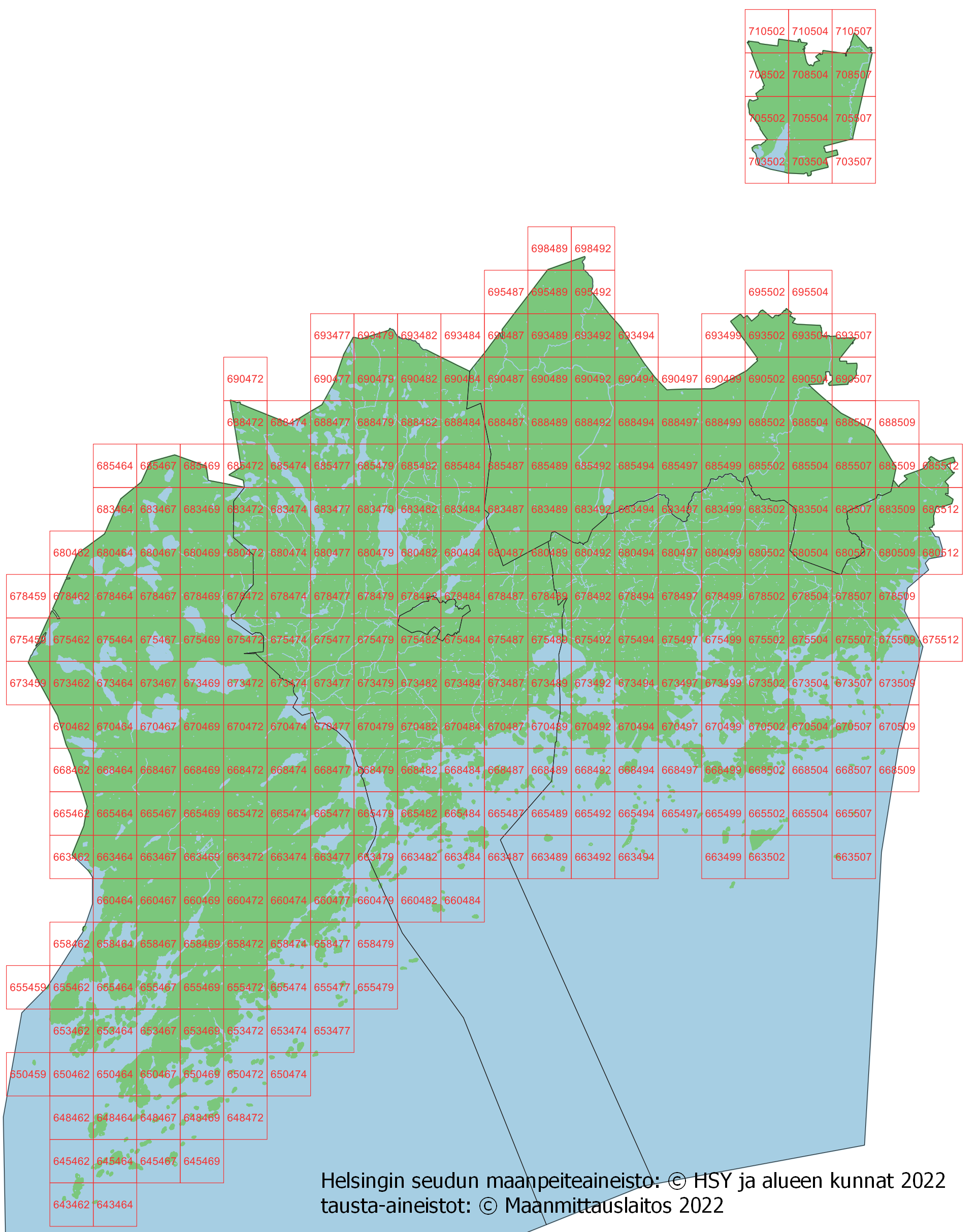
2022
In the 2022 project, AI was used in land cover classification for the first time. This enabled an iterative process which improved the classification during the production, especially in impervious and pervious surfaces. Due to the very detailed classification and the minimum mapping unit used in the dataset, there is seemingly more shallow vegetation and less trees in this version, compared to previous datasets. The dataset covers the cities of Helsinki, Espoo, Vantaa, Järvenpää, Kauniainen, Kirkkonummi and Järvenpää.
The following reference is used when presenting the Helsinki metropolitan area land cover dataset 2022: Helsinki metropolitan area land cover dataset: © HSY and municipalities in the region 2022; background materials: © National Land Survey of Finland 2022, © Finnish Transport Agency, Digiroad 2022
Instructions:
- Method description and quality assurance (in Finnish)
Download map sheet divisions:
- Index map 2022 (png)
- Land cover grid (shp)
- Land cover grid (tab)
2020
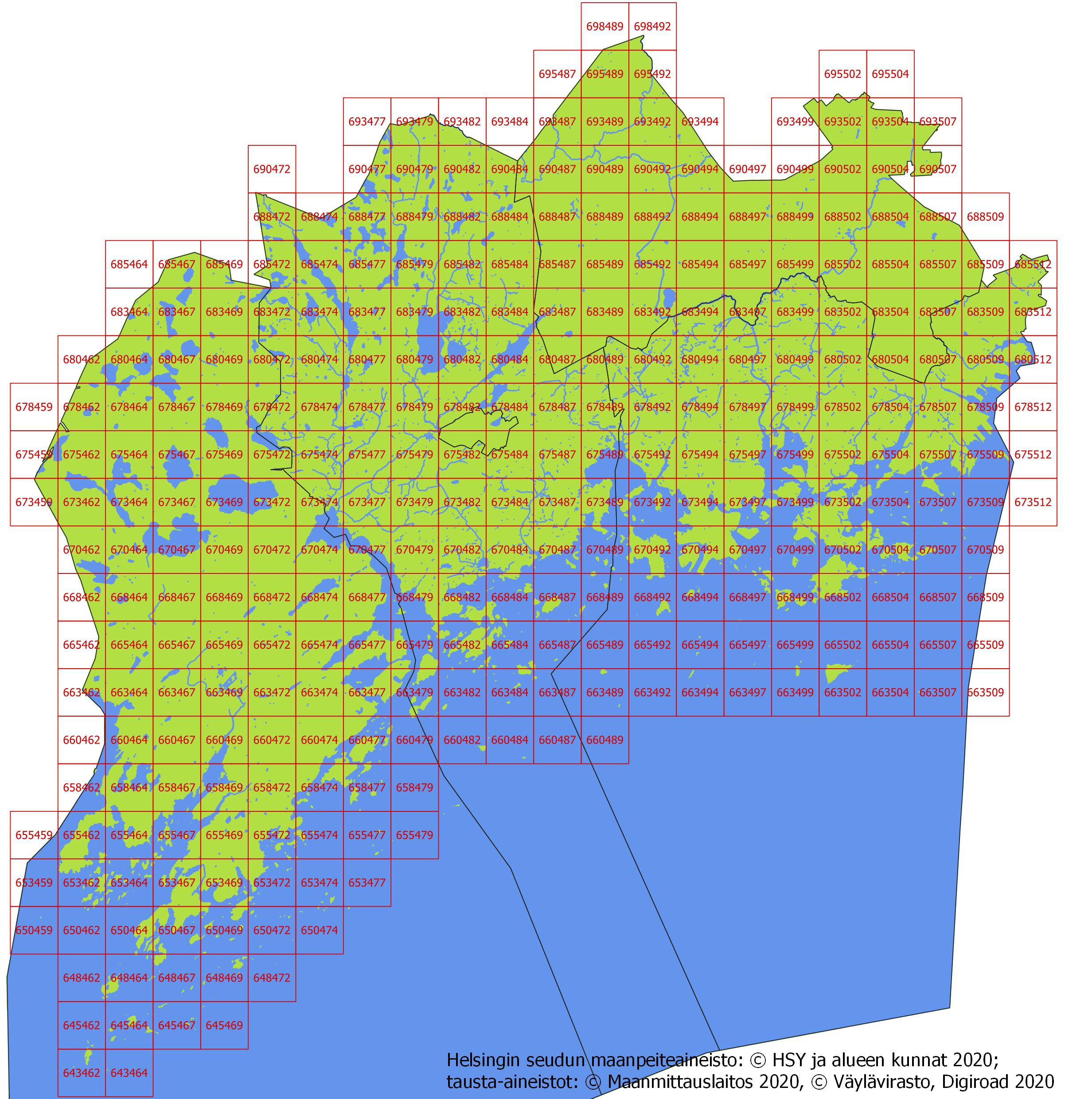
Datasets for 2020 and 2018 have been produced using the same exact method. However, there are significant differences in datasets due to temporal variation of the production of aerial orthoimages. Aerial orthoimages taken in 2020 were photographed later in summer than in 2018, and this results to considerably more shadows in images. Shadows complicate interpretation of images and land cover classification. Additionally, background material used in 2018 (locations of fields from Agency for Rural Affairs) is not used in 2020 dataset which also may result in differences.
The following reference is used in connection with the presentation of the Helsinki metropolitan area land cover dataset 2020: Helsinki metropolitan area land cover dataset: © HSY and municipalities in the region 2020; background materials: © National Land Survey of Finland 2020, © Finnish Transport Agency, Digiroad 2020
Instructions:
Download map sheet divisions:
- Index map 2020 (jpg)
- Land cover grid (shp)
- Land cover grid (tab)
2018
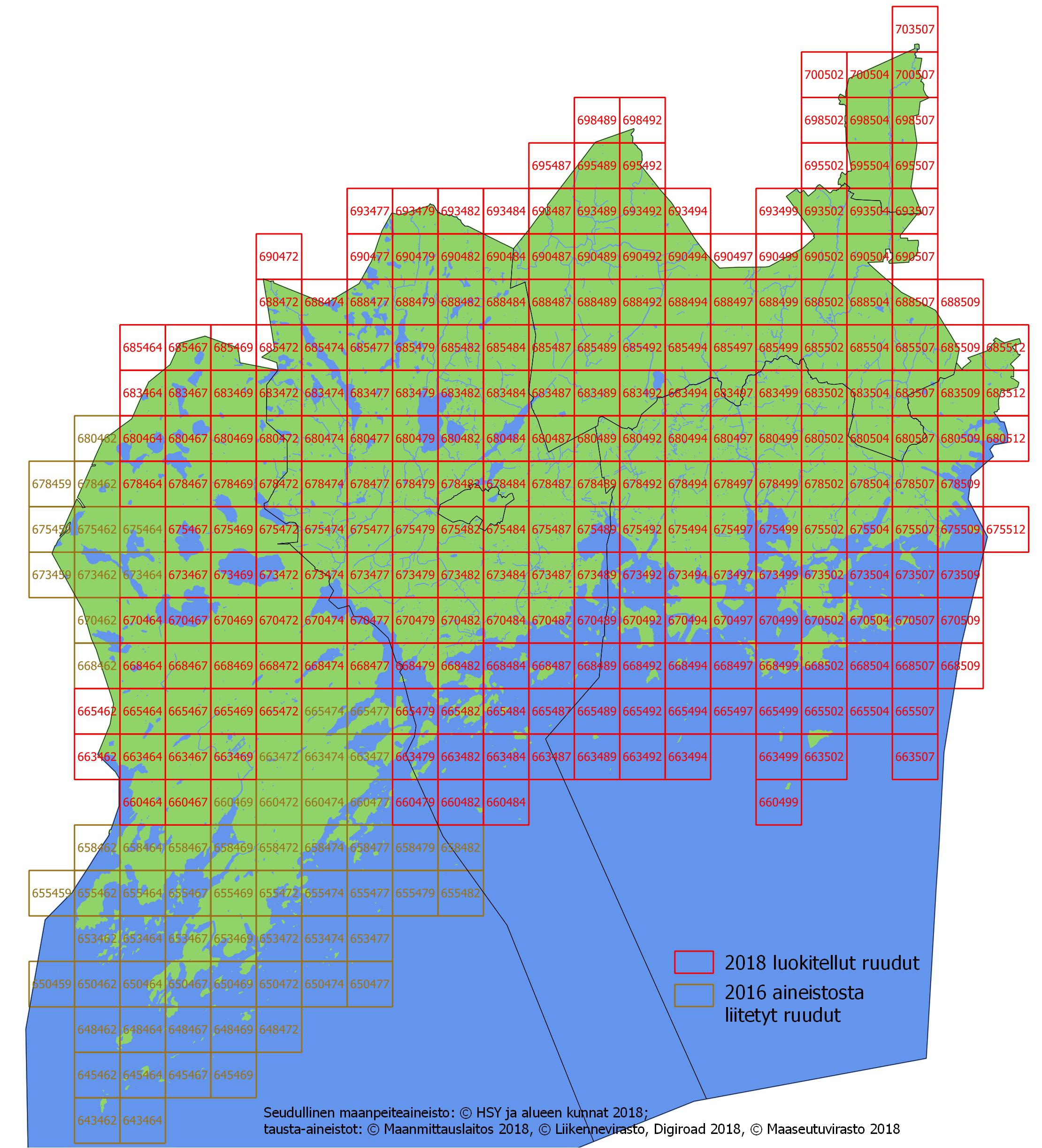
For Kirkkonummi, the 2018 land cover dataset consists partly of the data for 2016. See the index map for the dataset source distribution. The joining boundary has been implemented in the vector dataset so that the 2018 classification result has been combined with the 2016 dataset by merging objects of the same group over the joining boundary with a tolerance of 10 cm, so that only the geometries of the 2018 objects were allowed to move.
The following reference is used in connection with the presentation of the regional land cover dataset 2018: Regional land cover dataset: © HSY and municipalities in the region 2018; background materials: © National Land Survey of Finland 2018, © Finnish Transport Agency, Digiroad 2018, © Agency for Rural Affairs 2018
Instructions:
Download map sheet divisions:
- Index map 2018 (jpg)
- Land cover grid (shp)
- Land cover grid (tab)
2016
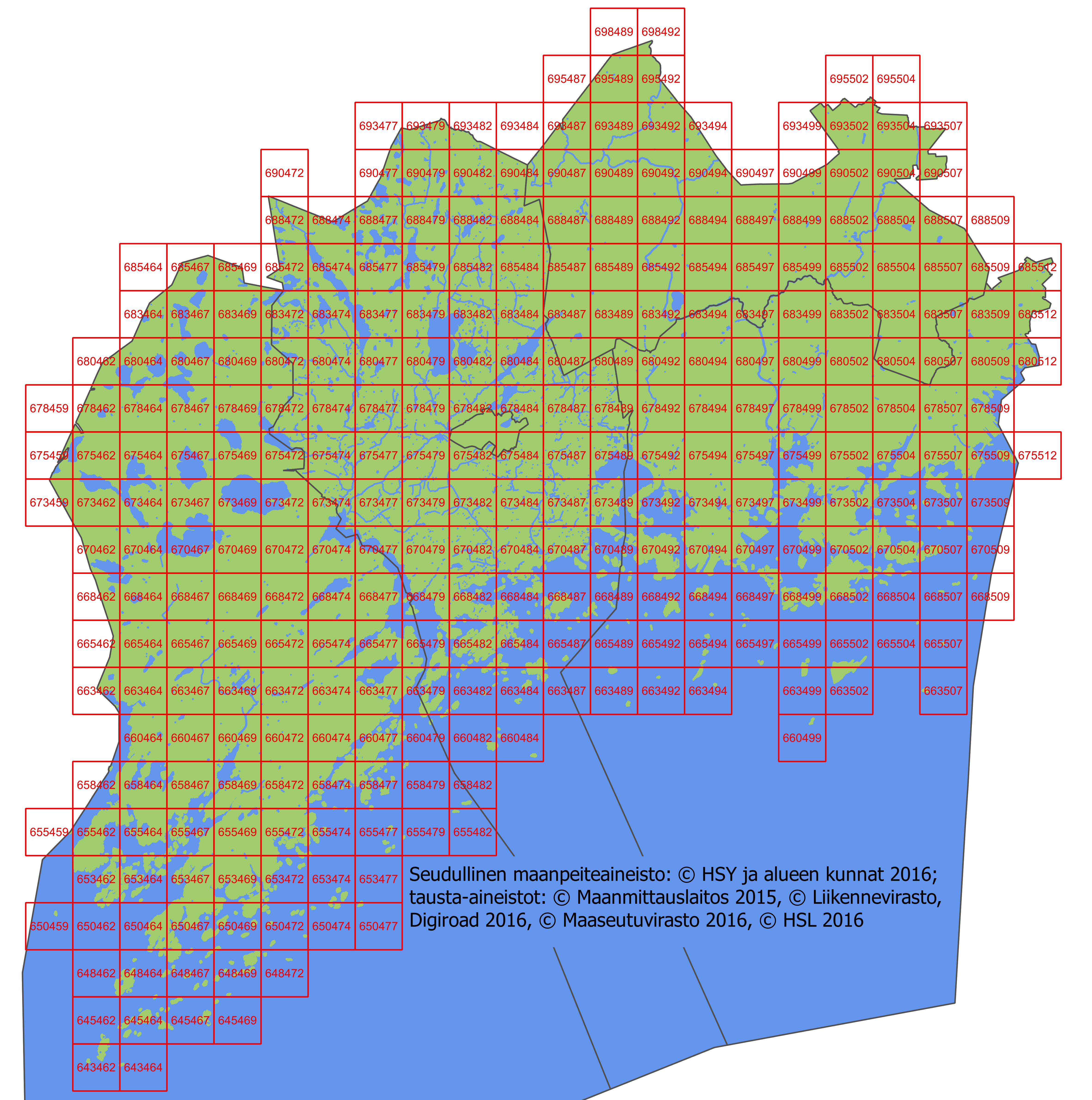
In addition to main dataset, similar land cover dataset was produced in the Southern Espoo area. In the process, a denser point cloud produced with a multi-channel laser scanner (Titan) was used instead of the Lidar materials from municipalities and the National Land Survey of Finland. This dataset, including area boundaries, is also available.
The following reference is used in connection with the presentation of the regional land cover material 2016: Regional land cover material: © HSY and municipalities in the region 2016; background materials: © National Land Survey of Finland 2015, © Finnish Transport Agency, Digiroad 2016, © Agency for Rural Affairs 2016, © HSL 2016
Instructions:
Download map sheet divisions:
- Index map 2016 (jpg)
- Land cover grid (shp)
- Land cover grid (tab)
2014
The following reference is used in connection with the presentation of the regional land cover dataset 2014: Regional land cover dataset: © HSY and municipalities in the region 2014; background materials: © National Land Survey of Finland 2013, © Finnish Transport Agency, Digiroad 2013.
Instructions:
Download map sheet divisions:
- Index map 2014 (jpg)
- Land cover grid (shp)
- Land cover grid (tab)
Due to the difficulty of separating bare ground and other impermeable surfaces, with the 2014 material, HSY also commissioned a second aerial photo interpretation with the same source materials, but with a different method. In the reclassification, only bare ground and other impermeable surfaces have been mapped by guided classification. Further inquiries: sepe@hsy.fi.
Resources
- WFS
- WMS
Additional Info
| Collection | Open Data |
|---|---|
| Maintainer | Helsingin seudun ympäristöpalvelut (HSY) |
| Maintainer email | |
| Maintainer website | http://www.hsy.fi/avoindata |
| Geographical coverage | |
| Update frequency | |
| Last modified |
01.03.2024 Show change log |
| Created on | 28.10.2015 |