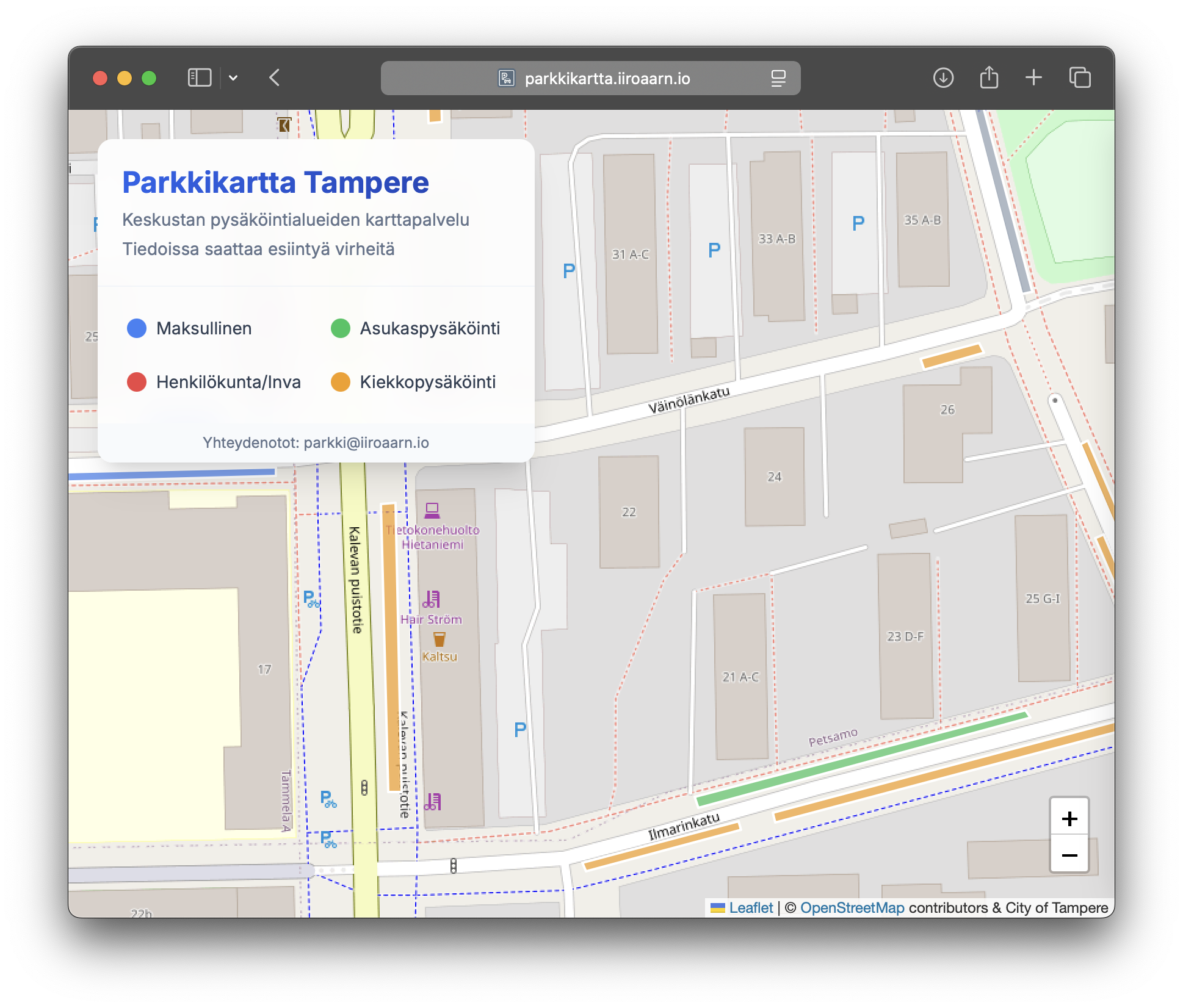
🅿️ Parkkikartta Tampere
Parkkikartta Tampere is a browser-based, interactive parking map that provides a clear and visual overview of parking areas in downtown Tampere.
Key Features
Interactive Map
- Displays parking zones on a city map.
- The map can be freely zoomed and panned.
- Clicking a parking zone reveals detailed information about parking rules and restrictions.
Purpose
This tool helps drivers:
- Save time when searching for parking.
- Plan ahead.
- Find the most suitable place to park based on their needs.
Color-Coded Parking Types
- Orange – Disc parking (requires a parking disc).
- Green – Residential parking (requires resident or business permit).
- Blue – Paid parking.
Use of Open Data
- Parking information is based on open data provided by the City of Tampere (data.tampere.fi).
- License: CC BY 4.0
Browser-Based Application
- No registration or installation required.
- Works directly on mobile and desktop devices.